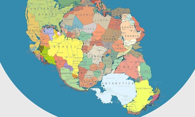
Imagine traveling from Brazil to the Congo, Pakistan to Somalia or even Mozambique to Antarctica – without setting foot on water.
Well, clearly you’ve missed your chance by a fair few years, as the supercontinent of Pangea no longer exists.
It started tearing itself apart 200 million years ago to slowly begin forming the continents and islands of the world we know today.
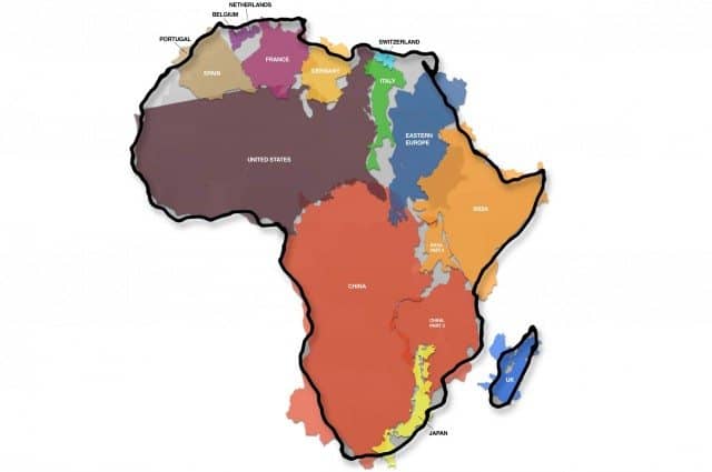
But thanks to the incredibly detailed illustrative talents of one Massimo Pietrobon, you can now see how modern day Africa would fit into the great prehistoric landmass of Pangea if today’s national boundaries and sovereignties had been around in the Palaeozoic era.
Back when the world’s continents were all part of one epic landmass, much of Africa was landlocked, surrounded on all sides by Antarctica, India, Arabia, Mediterranean Europe and Northern and Southern America.
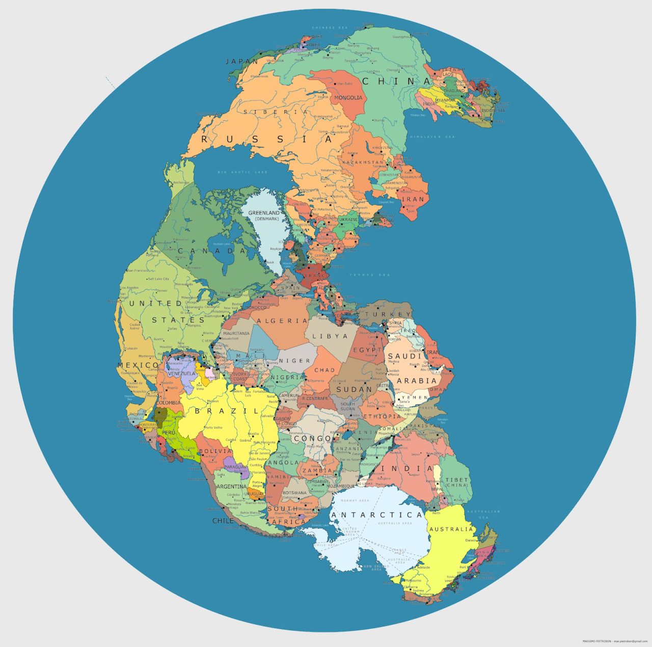
Surrounded by a superocean called Panthalassa, the bulk of Pangea huddles around Africa in the southern hemisphere, rather unlike how the continents are spread out now.
The shift from Pangea to today’s multi-continental land spread has been slowly unfolding over hundreds of millions of years, as heat radiating from within the Earth forces the lithosphere to move around.
Much of the evidence for Pangea’s prehistoric existence has been found in matching fossils and rock formations discovered on parts of the Earth that are now ‘millions’ of miles apart.
Recent discoveries of similar fossils have been found in South Africa, India and Australia (such as the therapsid Lystrosaurus), and similar rock forms seen on the eastern coast of South America and the western coast of Africa.